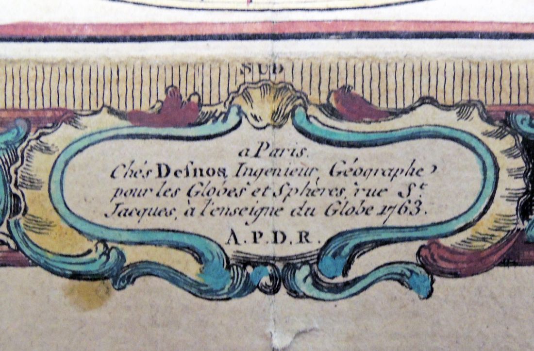
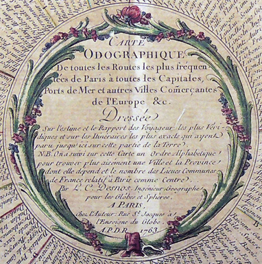
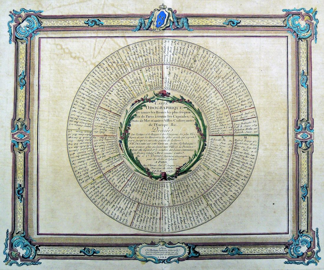
Louis-Charles Desnos (1725-1805), Carte odographique de toutes les routes les plus fréquentées de Paris à toutes les capitales, ports de mer et autres villes comerçantes de l’Europe &c. (Graphic measurements of all the most popular routes from Paris to all capitals, seaports and other European cities of commerce &c.) (Paris: Desnos, Ruë St. Jacques à l’enseigne du Globe, 1763). Graphic Arts Collection GAX 2016- in process
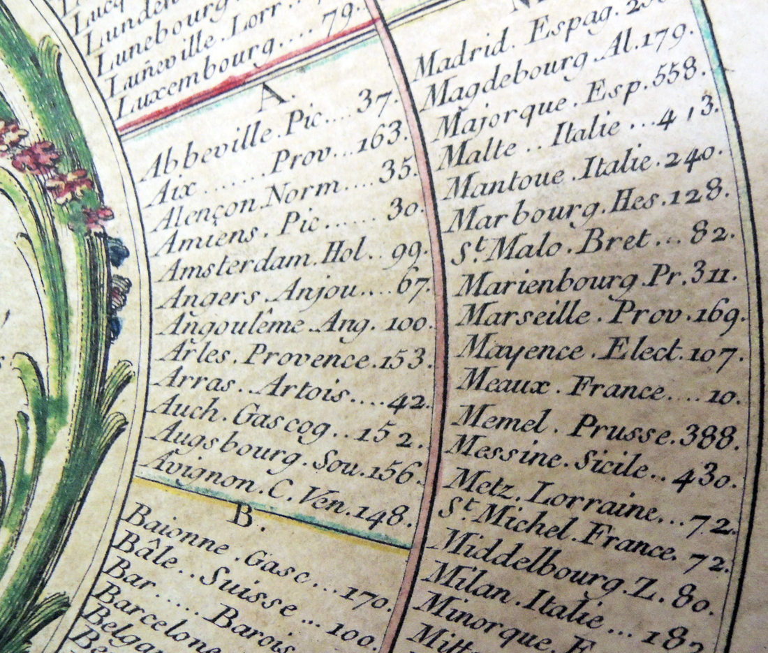
This hand colored chart provides a graphic depiction of the distances between Paris and “the main cities of the kingdom.” It was designed by cartographer and engraver Louis Charles Desnos (1725-1805) who both made and sold maps, globes, atlases, instruments, and books from his shop on Rue St. Jacques “at the sign of the globe.”
See also: Louis-Charles Desnos (1725-1805), Nouvel atlas de la généralité de Paris: divisé en ses 22 elections. . . (Paris: [Desnos], rue S. Jacques à l’enseigne du Globe, 1762). Marquand Library (SAX): Rare Books G1838 .D47 1762